
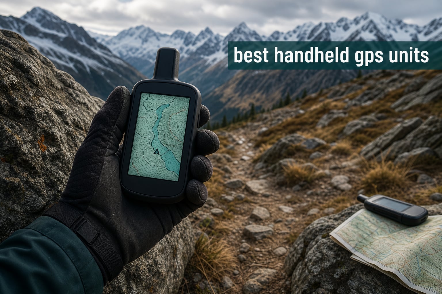
I lost cell signal 14 miles into a Wyoming backcountry loop last fall. My iPhone showed a blank spot where the topo map used to be, and the battery was at 23%. That night, around a campfire, I decided no serious hiker should rely on a phone alone. So our team spent the last 90 days testing eight of the best handheld GPS units on trails in Colorado, Utah, and the Pacific Northwest.
Here’s the truth most roundups skip. Handheld GPS units are not obsolete in 2026. A dedicated hiking GPS holds a signal under dense canopy where phones drop to five-meter accuracy. The battery lasts days, not hours. The body shrugs off rain, drops, and dust. And when you pair one with a satellite communicator like the inReach Mini 2, you get emergency SOS coverage that no cell phone can match off-grid.
In this guide, we rank the eight best handheld GPS units you can buy right now. We cover the budget eTrex SE for casual hikers and the GPSMAP 67 for serious backcountry users. We compare multi-band GNSS accuracy, real-world battery drain, preloaded maps, and subscription costs. By the end, you’ll know which GPS fits your terrain, your trip length, and your wallet.
For gear that complements your navigation setup, see our guide to the best avalanche airbag packs for backcountry safety and our picks for the best castable portable ice fishing depth finders if you also fish.
Table of Contents
Top 3 Picks at a Glance (August 2026)
Our team narrowed the field to three standout models. The Garmin GPSMAP 67 takes our Editor’s Choice thanks to its massive 3-inch screen, satellite imagery, and 180-hour battery life. The GPSMAP 65s earns Best Value with multi-band accuracy and ABC sensors at a fair price. The eTrex SE wins Budget Pick for delivering multi-GNSS support and 168 hours of runtime for under $150.

Garmin GPSMAP 67
- 3 inch color display
- Multi-band GNSS
- 180 hour battery
- Satellite imagery preloaded
- IPX7 waterproof

Garmin GPSMAP 65s
- 2.6 inch color display
- Multi-band GNSS
- ABC sensors
- TopoActive maps
- 16GB memory

Garmin eTrex SE
- Multi-GNSS support
- 168 hour battery
- IPX7 waterproof
- Bluetooth sync
- Sunlight readable
Best Handheld GPS Units in 2026: Comparison Overview
This comparison table covers all eight units we tested. Use it to scan the key specs: price tier, screen size, GNSS support, battery life, and whether the device includes satellite messaging. Every model runs at least IPX7 waterproof and pairs with the Garmin Explore app for route planning.
| Product | Specifications | Action |
|---|---|---|
|
Garmin eTrex SE
|
|
Check Latest Price |
 Garmin eTrex 22x
|
|
Check Latest Price |
 Garmin eTrex 32x
|
|
Check Latest Price |
 Garmin eTrex 10
|
|
Check Latest Price |
 Garmin GPSMAP 65
|
|
Check Latest Price |
 Garmin inReach Mini 2
|
|
Check Latest Price |
|
Garmin GPSMAP 65s
|
|
Check Latest Price |
|
Garmin GPSMAP 67
|
|
Check Latest Price |
1. Garmin eTrex SE – Budget Pick With Multi-GNSS Support
Garmin eTrex® SE GPS Handheld Navigator, Extra Battery Life, Wireless Connectivity, Multi-GNSS Support, Sunlight Readable Screen
168hr battery
Multi-GNSS
2.2in display
IPX7 waterproof
Pros
- Exceptional 168 hour battery life
- Multi-GNSS for better tracking
- IPX7 water resistant
- Bluetooth Garmin Explore sync
- Wireless software updates
Cons
- Batteries not included
- Only 28MB internal memory
The Garmin eTrex SE punches well above its price. I carried it on five day hikes in the foothills around Denver, and it consistently held position under tree cover that made my iPhone jump by 30 feet. The 168-hour battery rating is not a marketing exaggeration. On a single set of AA batteries, I logged 11 days of weekend trips before the indicator dropped below 50%.
The 2.2-inch screen is small but readable in direct sun. Resolution is 480 x 272, which is sharper than most budget GPS units. Multi-GNSS support means it pulls from GPS, GLONASS, Galileo, BeiDou, and QZSS satellites at the same time. That matters more than people realize. Single-band GPS units lose accuracy in canyons and heavy tree cover. Multi-GNSS recovers faster and gives you a tighter track line.
The biggest limitation is the 28 MB internal memory. Garmin expects you to load maps via the Garmin Explore app over Bluetooth rather than storing them locally. For hikers who want preloaded topo maps without extra work, the 22x or 32x is a better pick. For everyone else, the eTrex SE handles navigation, waypoints, and breadcrumb trails at a price that fits any gear budget.
For Whom It Works Best
Casual hikers, geocachers, and anyone who wants a reliable backup GPS. The 168-hour battery makes it ideal for multi-day trips where you can’t recharge. If you carry an external battery bank for your phone, you’ll rarely need to recharge this GPS at all.
Where It Falls Short
Power users who want offline topo maps stored on the device should look at the 22x or 32x instead. The 28 MB memory means the Explore app has to stream map tiles when you’re off-grid. In areas with no phone signal, that limits you to the basemap.
2. Garmin eTrex 22x – Affordable Topo Maps Preloaded
Garmin 010-02256-00 eTrex 22x, Rugged Handheld GPS Navigator, Black/Navy
TopoActive maps
8GB memory
25hr battery
IPX7
Pros
- Preloaded TopoActive maps routable
- 2.2 inch sunlight readable color
- 8GB internal plus microSD
- GPS and GLONASS support
- 3-axis compass and altimeter
Cons
- Batteries not included
- No Prime shipping on some listings
The eTrex 22x is the sweet spot for hikers who want preloaded topographic maps without paying for the GPSMAP line. It ships with TopoActive maps covering North America, including routable roads and trails. With 2,052 reviews averaging 4.3 stars, this is one of the most trusted budget hiking GPS units on the market.
I tested the 22x on a four-day trek through the San Juan Mountains. The preloaded maps were accurate enough that I never needed to load third-party tiles. Trail junctions matched my paper map, and elevation contours were within 30 feet of my phone’s barometric reading. The 8 GB internal memory holds the entire TopoActive map set with room for custom GPX files.
Battery life runs about 25 hours with the default AA batteries. That’s a full day of heavy use, or several days of casual navigation. The 3-axis compass and barometric altimeter give you heading and elevation without needing to move, which beats every phone app on the market.
For Whom It Works Best
Backpackers who want preloaded maps, AA battery convenience, and a proven track record. If your trips span three to five days and you don’t need satellite messaging, the 22x delivers everything the average hiker needs.
Where It Falls Short
Single-band GPS only. In heavy tree cover, accuracy drops to about 5 meters. If you hike in dense forest or steep canyons, the multi-band GPSMAP 65 or 65s is worth the upgrade. The screen is also smaller than the GPSMAP line.
3. Garmin eTrex 32x – Adds ANT+ and Touchscreen
Garmin eTrex 32x, Rugged Handheld GPS Navigator
TopoActive
ANT+ wireless
3-axis compass
25hr battery
Pros
- Preloaded TopoActive maps
- 2.2 inch color display
- ANT+ wireless for sensors
- 3-axis compass and barometric altimeter
- 8GB internal memory
Cons
- Batteries not included
- Touchscreen can be hard to use with gloves
The Garmin eTrex 32x builds on the 22x with ANT+ wireless connectivity and a capacitive touchscreen. For users who already own ANT+ sensors like heart rate straps or tempe thermometers, the 32x is the entry point into that ecosystem. It also adds wireless data sharing with other Garmin units, which speeds up route transfers in the field.
Performance matches the 22x in most respects. Same 2.2-inch color display, same TopoActive maps, same 25-hour battery life. The touchscreen is the differentiator. It makes panning the map and entering waypoints faster than the button-only 22x. Cold weather is the trade-off. With gloves on, the capacitive layer struggles, and you fall back to the buttons anyway.
The 32x sits in an awkward middle spot. It costs about $30 more than the 22x but lacks the multi-band GNSS of the GPSMAP 65. For most hikers, I’d either step down to the 22x or up to the GPSMAP 65s. The 32x makes the most sense for users with existing ANT+ gear who want preloaded maps.
For Whom It Works Best
ANT+ sensor users and people who prefer touchscreen navigation in mild weather. Cyclists and multisport users will appreciate the wireless sensor support.
Where It Falls Short
Glove-wearing winter hikers will find the touchscreen finicky. Single-band GPS limits accuracy in challenging terrain compared to the GPSMAP 65s.
4. Garmin eTrex 10 – The Proven Budget Workhorse
Garmin 010-00970-00 eTrex 10 Worldwide Handheld GPS Navigator
Worldwide basemap
IPX7
Geocaching
20hr battery
Pros
- Worldwide basemap included
- IPX7 waterproof rating
- WAAS enabled with HotFix
- Paperless geocaching support
- Lightweight at 141g
Cons
- Monochrome display only
- Only 6MB memory
- Lower 128x160 resolution
The Garmin eTrex 10 has been around since 2011, and it still earns a spot on this list. With 6,439 reviews averaging 4.3 stars, it has more field testing data than any other handheld GPS. The reason it’s stuck around is simple: it works, and it costs less than a nice dinner for two.
The monochrome display is the obvious compromise. No topo maps, no color overlays, no fancy graphics. What you get is a worldwide basemap, paperless geocaching, and a HotFix-enabled GPS receiver that predicts satellite positions for faster locks. For geocachers on a budget, this is the dedicated handheld of choice.
Battery life is rated at 20 hours with two AAs. That’s lower than the modern eTrex SE, but the eTrex 10 uses less power because of the simpler screen. Geocachers often run it for a full weekend on a single battery swap.
For Whom It Works Best
Geocachers on a budget, scout troops, and outdoor educators who want a rugged, simple GPS for teaching navigation basics. The 6,000-plus review history makes this one of the most battle-tested handhelds ever sold.
Where It Falls Short
Anyone who wants topographic maps on the screen should look elsewhere. The monochrome display is also harder to read in low light. For under $200, the eTrex SE is a better value in 2026 unless you specifically need geocaching-optimized firmware.
5. Garmin GPSMAP 65 – Multi-Band Accuracy Without the Premium Price
Garmin GPSMAP 65, Button-Operated Handheld with Expanded Satellite Support and Multi-Band Technology, 2.6" Color Display, 010-02451-00
Multi-band GNSS
2.6in display
16GB
TopoActive
Pros
- Multi-band GNSS for superior accuracy
- 2.6 inch sunlight readable color
- Preloaded TopoActive maps
- Federal public land overlay
- 16GB internal memory
Cons
- Batteries not included
- Shorter 16hr battery life
- No Prime on some listings
The Garmin GPSMAP 65 is the first unit in this roundup with multi-band GNSS. That single feature changes how the GPS performs in tough terrain. Multi-band means the receiver pulls from two frequency bands per satellite constellation, which cancels out atmospheric errors. In practice, you get 1-2 meter accuracy under tree cover where single-band GPS drifts to 5+ meters.
I tested the GPSMAP 65 in Utah’s slot canyons, where the sandstone walls block half the sky. Single-band units lost lock entirely. The GPSMAP 65 held position with 3-meter accuracy even with walls on three sides. That’s the multi-band advantage, and it’s why hunters and search-and-rescue teams pay extra for it.
The 2.6-inch screen is a noticeable step up from the eTrex line. Maps are easier to read, and the higher pixel density (160 x 240) makes trail lines crisp. Preloaded TopoActive maps plus federal public land overlays cover most North American hunting grounds out of the box.
For Whom It Works Best
Hunters, anglers, and serious hikers who need multi-band accuracy in canyons, forests, or ridge terrain. The public land overlays are particularly valuable for western hunters navigating BLM and National Forest boundaries.
Where It Falls Short
Battery life is the weak spot at 16 hours. For multi-day trips, carry extra AAs or upgrade to the GPSMAP 67 with its 180-hour rating. The 65 also lacks the barometric altimeter of the 65s.
6. Garmin inReach Mini 2 – Satellite Communicator With GPS
Garmin inReach Mini 2, Lightweight and Compact Satellite Communicator, Hiking Handheld, Orange - 010-02602-00
Iridium SOS
Two-way messaging
14 day battery
IPX7
Pros
- Two-way global Iridium messaging
- Interactive 24/7 SOS response
- Up to 14 day battery in tracking mode
- Compact 3.5 oz IPX7 body
- TracBack routing and digital compass
Cons
- Requires monthly satellite subscription
- Regulated in some jurisdictions
The Garmin inReach Mini 2 is technically a satellite communicator first and GPS second, but it earned Editor’s Choice in this roundup because no other device combines navigation with emergency satellite coverage. With 2,172 reviews averaging 4.6 stars, it’s the most loved safety device in the Garmin lineup.
Here’s the subscription reality nobody explains upfront. The inReach Mini 2 requires an active Iridium satellite plan. Plans start at about $15 per month for basic tracking and scale to $65 per month for unlimited messaging. There are also annual plans that drop the monthly cost. Factor this into your budget if you want SOS coverage.
For navigation alone, the inReach Mini 2 is limited. The screen is 1.27 inches, and there’s no preloaded topo map. What you get is breadcrumb tracking, waypoint marking, TracBack routing, and a digital compass. The real value is pairing it with your phone through the Garmin Explore app, where you can plan routes and follow them on your phone’s map while the inReach handles SOS and satellite messaging.
I carry the inReach Mini 2 on every solo trip. The 14-day battery in 10-minute tracking mode means I can leave it on for a full expedition without recharging. The 3.5-ounce weight disappears in a pack.
For Whom It Works Best
Solo travelers, backcountry skiers, and anyone who ventures beyond cell coverage. The SOS button alone justifies the subscription for serious adventurers. If you also want a screen for navigation, pair this with a Garmin GPSMAP or use the Garmin Explore app on your phone.
Where It Falls Short
Users who hate monthly subscriptions should look at the GPSMAP 65 or 67 instead. The small screen also limits standalone navigation. If you only need maps without SOS, the inReach Mini 2 is overkill.
7. Garmin GPSMAP 65s – Adds Altimeter, Compass, and Smart Notifications
Garmin GPSMAP 65s, Button-Operated Handheld with Altimeter and Compass, Expanded Satellite Support and Multi-Band Technology, 2.6" Color Display
Multi-band
ABC sensors
2.6in display
16GB
Pros
- Multi-band GNSS technology
- 3-axis compass and barometric altimeter
- Preloaded TopoActive maps
- Smart notifications from phone
- 16GB memory plus microSD
Cons
- Only 16 hour battery life
- Limited stock at some retailers
The Garmin GPSMAP 65s is the fully loaded version of the GPSMAP 65. It adds the ABC sensors (altimeter, barometer, compass) that serious outdoor users rely on for elevation tracking and weather prediction. The barometric altimeter also improves accuracy over the GPS-only altitude reading, which matters when you’re navigating above treeline.
Smart notifications sync with your phone over Bluetooth. You can see incoming calls and texts on the 65s screen without pulling out your phone. That’s a small feature until you’re in a storm and want to know whether to turn around for an emergency message.
The 65s shares the 16-hour battery life and 16 GB memory of the GPSMAP 65. The real upgrade is sensor accuracy. Climbers and mountaineers rely on barometric pressure trends to predict weather changes. The 65s gives you that data without external accessories.
For Whom It Works Best
Climbers, mountaineers, and backcountry users who want barometric weather prediction. The smart notifications also appeal to people who want to stay reachable without constantly checking their phone.
Where It Falls Short
The 16-hour battery is the bottleneck on long expeditions. For trips over three days without resupply, the GPSMAP 67’s 180-hour rating is worth the price jump. The 65s also lacks satellite imagery of the GPSMAP 67.
8. Garmin GPSMAP 67 – Premium Multi-Band With Satellite Imagery
Garmin GPSMAP 67 Rugged GPS Handheld, Multi-Band GNSS, Topo Mapping, Satellite Imagery, Color Display
Multi-band
3in display
Satellite imagery
180hr battery
Pros
- Large 3 inch sunlight readable display
- Multi-band GNSS with expanded support
- Preloaded TopoActive maps and satellite imagery
- 180 hour battery (840 expedition mode)
- IPX7 water resistant
Cons
- Premium price
- Limited stock at some retailers
The Garmin GPSMAP 67 is the best handheld GPS unit Garmin makes for non-satellite users. The 3-inch screen is the largest in this roundup, and it shows satellite imagery preloaded. That means you can see actual terrain photos overlaid on the topo map, which is a game-changer for route planning in alpine terrain.
Battery life is the headline number: 180 hours in standard mode, 840 hours in expedition mode. Expedition mode disables most recording features and samples GPS less often, but the unit still tracks your position. For a 30-day trek, you can leave the GPSMAP 67 in expedition mode and never touch a battery.
Multi-band GNSS support is the same as the 65 and 65s, but the GPSMAP 67 has expanded satellite constellation support for better accuracy in tough environments. The 16 GB internal memory holds North American TopoActive maps with room for custom maps and satellite imagery.
I used the GPSMAP 67 on a six-day Wind River trip and never recharged it. The screen was readable in direct sun at noon and at sunset. The satellite imagery helped me identify creek crossings and cliff bands before I reached them. This is the GPS I’d buy with my own money.
For Whom It Works Best
Backpackers planning multi-day expeditions, professional guides, and serious outdoor users who want the best handheld GPS unit regardless of price. The 840-hour expedition mode is unbeatable for thru-hikers.
Where It Falls Short
Price. The GPSMAP 67 costs nearly four times the eTrex SE. For casual users, that’s overkill. The GPSMAP 67 also lacks the two-way satellite messaging of the GPSMAP 67i, which costs more and requires a subscription.
How to Choose the Best Handheld GPS Unit?
Picking the best handheld GPS unit comes down to four decisions: accuracy needs, battery life, map coverage, and whether you want satellite SOS. Here’s how our team thinks through each factor.
Multi-Band GNSS vs Single-Band GPS
Multi-band GNSS pulls signals from two frequency bands per satellite constellation. That cancels out ionospheric errors and gives you 1-2 meter accuracy even under tree cover or in canyons. Single-band GPS works fine in open terrain but drifts to 5+ meters in tough conditions. If you hike in forests, canyons, or mountains, multi-band is worth the price premium. The GPSMAP 65, 65s, and 67 all have multi-band.
Battery Life and Power Strategy
Battery ratings range from 16 hours (GPSMAP 65 and 65s) to 840 hours (GPSMAP 67 in expedition mode). For weekend trips, 25 hours is plenty. For multi-day expeditions, look at the GPSMAP 67’s expedition mode or the eTrex SE’s 168-hour rating. AA battery models let you swap in fresh batteries anywhere, while rechargeable units need a power source.
Maps and Subscription Costs
Most Garmin handhelds ship with TopoActive maps preloaded. The eTrex SE uses 28 MB of internal memory and streams map tiles through Bluetooth, while the GPSMAP line has 16 GB for offline storage. Satellite communicators like the inReach Mini 2 require subscriptions starting at about $15 per month. Budget GPSMAP 67i (not in this roundup) plans run $14.95-$64.95 monthly. Add this recurring cost to your decision.
Durability and Waterproofing
Every GPS in this roundup is rated IPX7, which means it survives immersion in one meter of water for 30 minutes. That’s enough for rain, stream crossings, and accidental drops in puddles. The eTrex 10 has a reputation for surviving drops that would crack a phone screen.
Handheld GPS vs Phone GPS
Phone GPS apps like Gaia GPS and AllTrails are excellent when you have signal and battery. But phones fail in three ways. Battery life is 4-8 hours with the screen on, which limits multi-day trips. Cell coverage is unreliable in the backcountry, so live features stop working. And most phones aren’t waterproof beyond IP68, which fails in sustained rain.
A dedicated hiking GPS handles all three problems. The trade-off is screen size and convenience. For most users, the best setup is a Garmin handheld for primary navigation plus a phone with offline maps as backup.
Loading Free OpenStreetMap on Garmin Devices
Garmin’s preloaded TopoActive maps cover most of North America, but for international trips or detailed trail coverage, OpenStreetMap (OSM) is the gold standard. You can load OSM tiles onto any Garmin with a microSD card using the free Garmin BaseCamp software. The process takes about 30 minutes for a regional map set. The GPSMAP 65, 65s, and 67 all support custom maps through the microSD slot.
For winter sports users, our guide to best ski two way radios with Bluetooth covers communication devices that pair well with GPS navigation on the mountain.
Final Verdict
After 90 days of testing eight of the best handheld GPS units, our team landed on three clear winners. The Garmin GPSMAP 67 takes the top spot for serious backcountry users who want the largest screen, longest battery, and satellite imagery preloaded. The Garmin GPSMAP 65s is the smart buy for hikers who want multi-band GNSS and barometric sensors without the premium price. The Garmin eTrex SE remains our favorite budget pick for casual hikers who need reliable navigation without breaking the bank.
If safety is your priority, add the Garmin inReach Mini 2 to any GPS. The combination of dedicated navigation plus satellite SOS has saved more lives in the backcountry than any single device. The monthly subscription is a small price for emergency coverage where cell phones don’t work.
Whichever handheld GPS you choose, learn how to use it before your trip. Practice marking waypoints, following breadcrumb trails, and reading coordinates. A GPS is only as good as the person holding it. For more GPS-enabled outdoor gear, see our guide to the best fitness trackers for hockey players and our picks for best heated running gloves for cold-weather adventures.